 CAPACUANSMALL SCALE
Manila
The easternmost vein. It trends north-northeast, dips about 45° to the northwest, can be followed at the surface for more than 800 m and is up to about 1 m thick. Before the war at least 2,200 m of tunnels were driven on it.
HomeJose Panganiban & Paracale, Camarines Norte
Our Minahang Bayan sits on ground with several gold- and silver-bearing veins. Independent geologists studied the vein systems in 2026.
In short
Vein map
The main vein zone lies between the Manila Vein to the southeast and the Virginia Vein to the northwest. The Manila and Vallejo veins run parallel, about 300 metres apart.
The vein zone
Four vein systems, the Manila, Vallejo, Pasacao and Virginia veins, sit within a zone of roughly 900 by 1,000 metres. Each is made up of a main quartz vein, altered rock along its edges, and smaller veinlets and stockworks that run beside and across it. The San Rafael Vein lies just west of this zone and almost joins the Virginia Vein at its southern end.
The veins lie in the Paracale Nacional area, an abandoned pre-war gold mine later explored by Philippine Iron Mines, Benguet Corporation and Bulawan Mineral Resources. Those companies did not go into large-scale production, likely because the quartz veins are narrow, averaging about 0.70 metres, and gold values are erratic. That makes the ground poorly suited to large-tonnage mining, and well suited to selective mining of the veins.
The ground has potential for two kinds of mining: selective mining of the high-grade veins, and bulk mining of the gold and base-metal mineralisation around them.
The veins up close
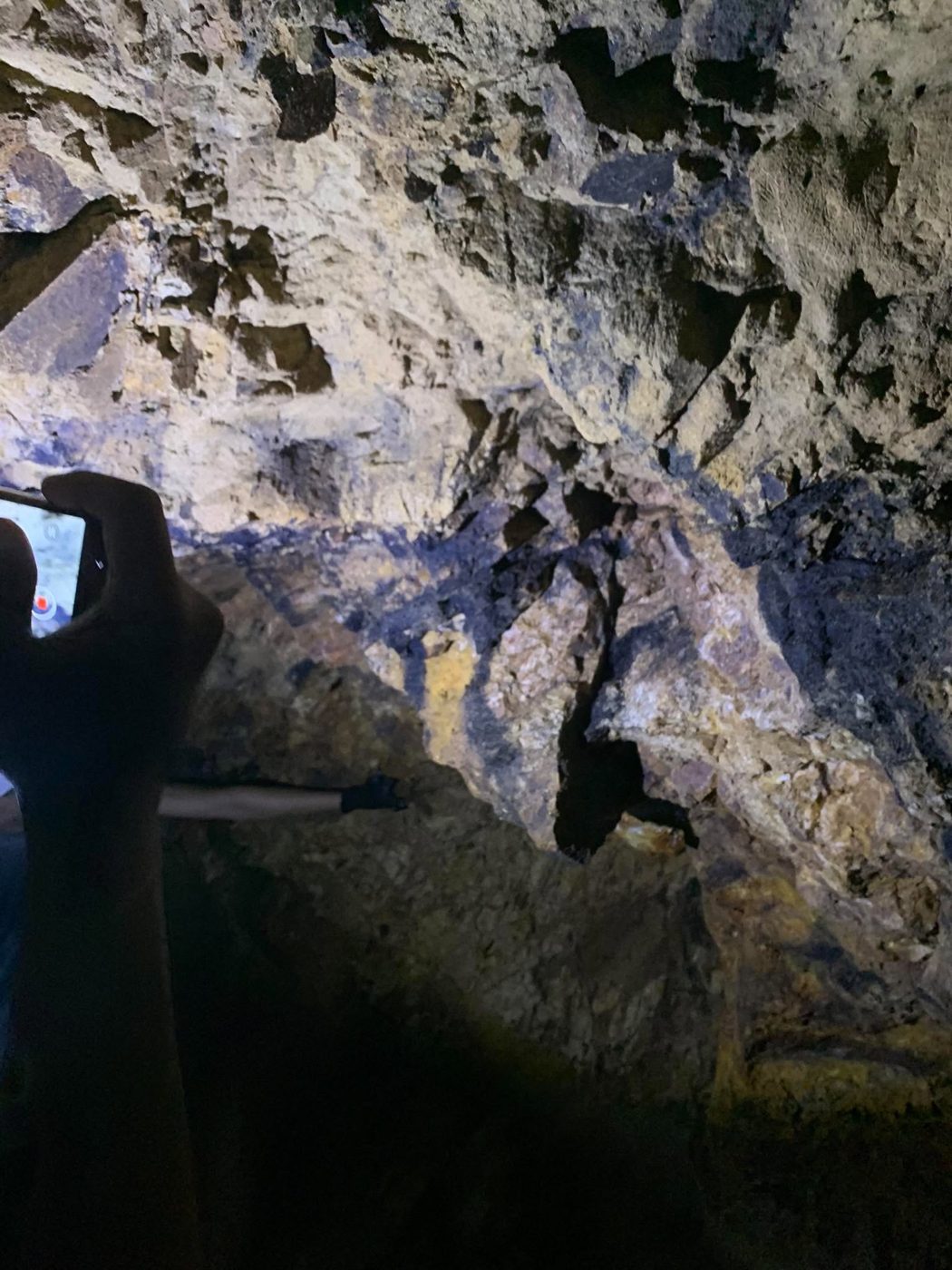
The easternmost vein. It trends north-northeast, dips about 45° to the northwest, can be followed at the surface for more than 800 m and is up to about 1 m thick. Before the war at least 2,200 m of tunnels were driven on it.
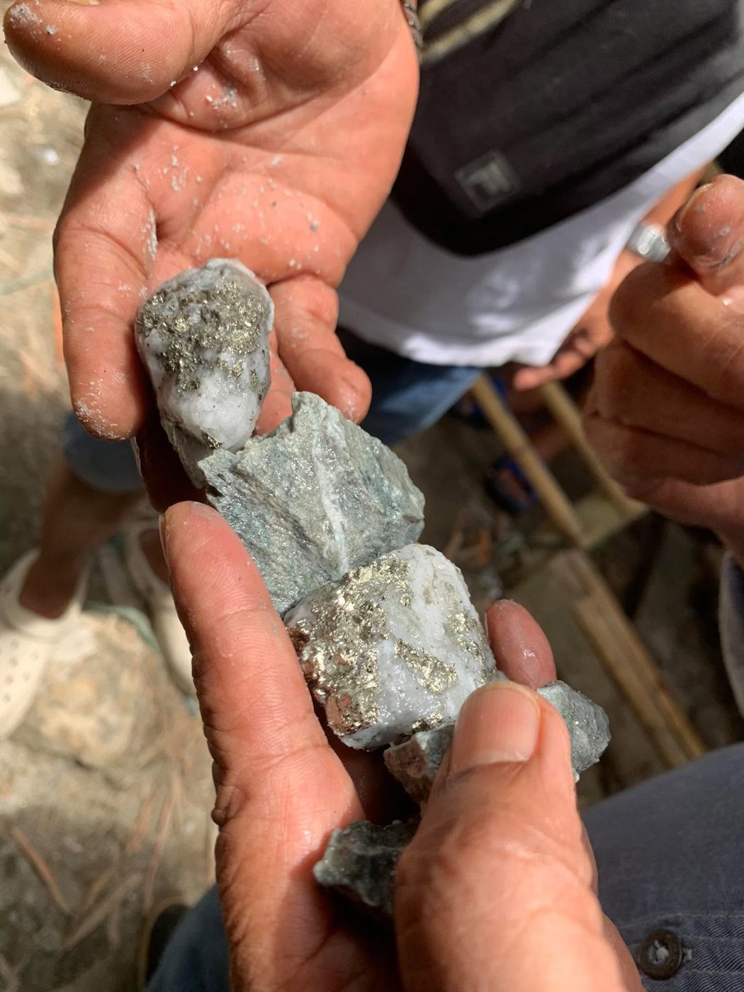
Runs parallel to the Manila Vein a few hundred metres to the west, in the same rock. About 40 cm thick, massive quartz with pyrite. Mined before the war, and worked by the Inocalla family in recent years.
Further west, trending northeast and dipping about 60°. A narrow quartz vein of about 25 cm, but with a zone of altered rock up to 30 m wide around it. Old shafts are still visible.
The westernmost vein, traced for more than 1 km and up to 1.8 m thick, with a halo of altered rock and quartz stockworks. The quartz carries galena, sphalerite, chalcopyrite and pyrite. The family has worked it in recent years.
Lies west of the Vallejo Vein. It has not yet been described in detail and has no recorded drilling or trenching, so it is an open target.
How it formed
A simplified story of the rocks, from J. C. Zafra (2022) and Aurelio & Peña, Geology of the Philippines (2010).
Slabs of old ocean crust were pushed up onto the edge of the Philippine island arc. They form the district’s basement rocks.
CRETACEOUSThe crust stretched and broke along faults. Sand, mud and volcanic ash filled the basins, becoming the Tumbaga Formation and the Larap Volcanic Complex that host our veins.
EOCENE–OLIGOCENEMolten rock rose along the faults and cooled underground. The largest body, the Paracale Granodiorite, is about 17 km long and 4 km wide.
MIOCENE–PLIOCENEHot water from the magma flowed up through cracks in the rock and cooled near the surface, leaving quartz, sulphides, gold and silver behind. Geologists call these low-sulphidation epithermal veins.
LATE PLIOCENEThe land rose and wore away, bringing the veins close to the surface and washing loose gold into the rivers, the placer gold Paracale has been known for since the 12th century.
TO TODAYField samples
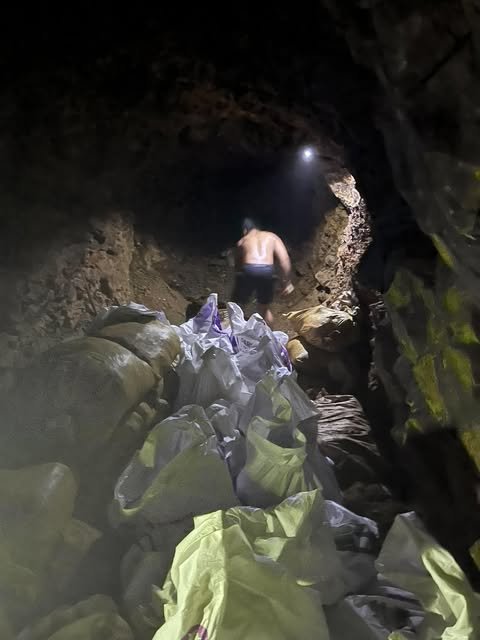
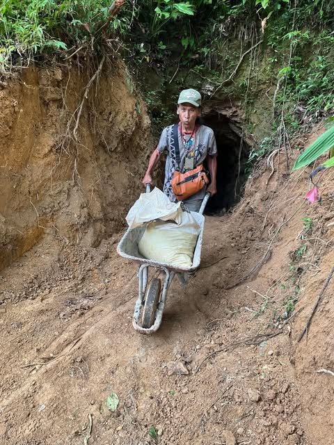
In August 2026, six rock samples were collected from the Manila Vein (Tunnel 1), the Vallejo and Tumbaga veins, and a small-scale miners’ shaft, and sent to the Mines and Geosciences Bureau laboratory for gold and copper analysis.
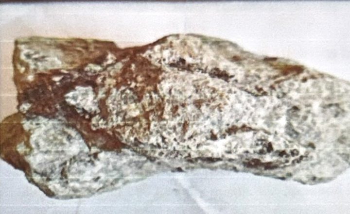
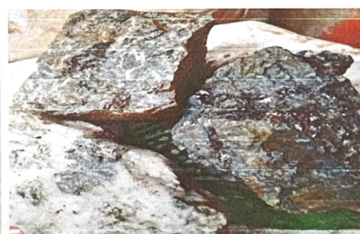
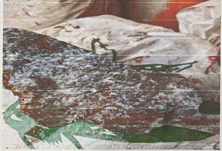
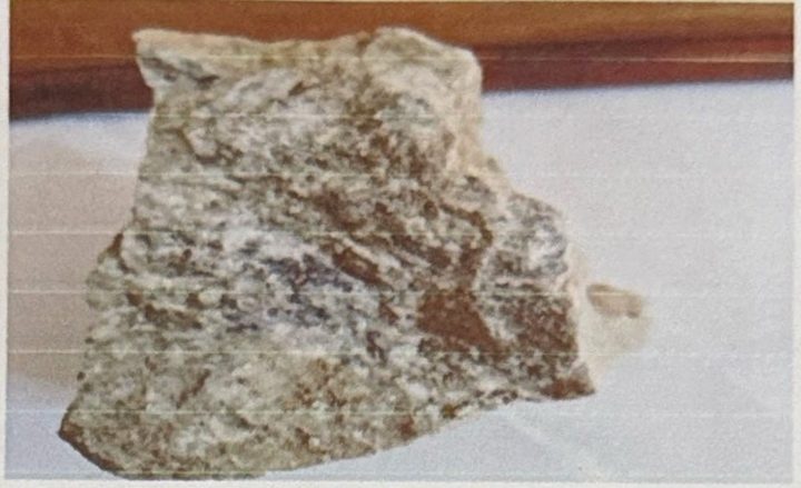
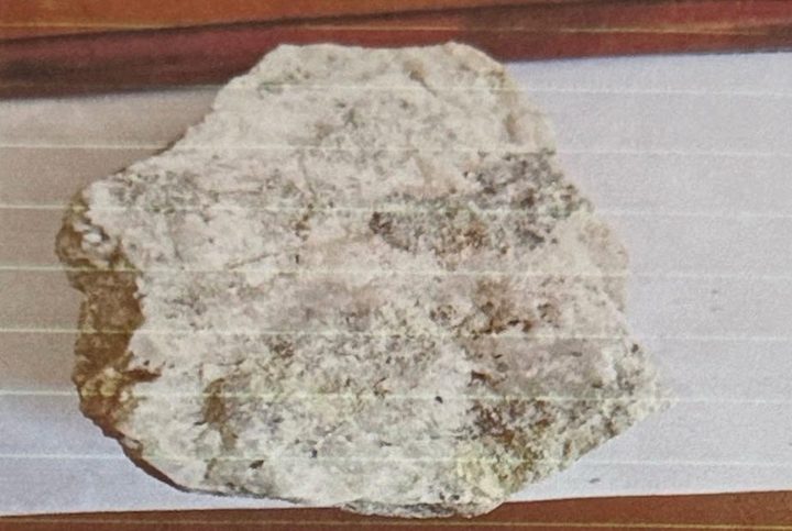
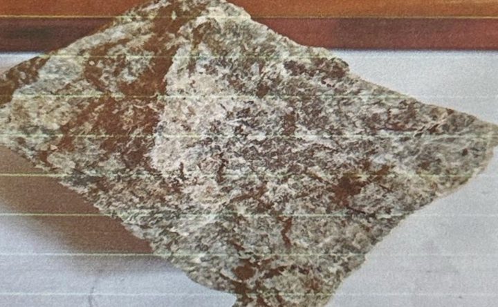
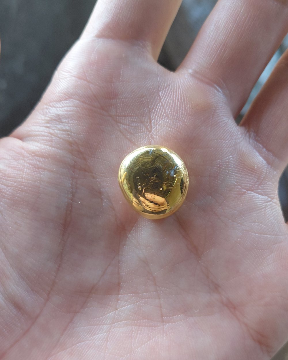
Field photos from the August 2026 sampling. Grab samples are selective and do not represent the average grade of a vein. Laboratory results are shared with interested investors on request.
Historical estimates
| Vein · block | Width | Tonnes | Grade (g/t Au) | Contained gold |
|---|---|---|---|---|
| Manila · South | 0.84 m | 19,647 | 5.50 | 108 kg |
| Manila · Central | 0.78 m | 12,246 | 4.40 | 54 kg |
| Manila · North | 0.98 m | 13,187 | 7.50 | 99 kg |
| Vallejo · South | 0.83 m | 20,211 | 6.50 | 131 kg |
| Vallejo · South central | 0.88 m | 21,804 | 5.50 | 120 kg |
| Vallejo · Central | 0.76 m | 8,767 | 4.90 | 43 kg |
| Vallejo · North | 0.76 m | 6,332 | 5.20 | 33 kg |
| Virginia | 6.40 m | 55,120 | 1.27 | 70 kg |
| Total | 157,314 | 4.18 avg. | ≈ 658 kg (≈ 21,200 oz) |
Historical estimates made by Benguet Corporation, as tabulated in the September 2026 report by Acenas & Vargas. They predate current reporting standards (NI 43-101 / JORC), have not been verified by a qualified person, and are not current mineral resources or reserves. Contained gold is tonnes × grade, before any recovery losses. Use them only as a guide to where gold has been found.
Reference figures
| Figure | Covers | Gold | Reference value* | Based on |
|---|---|---|---|---|
| Historical estimate | Manila, Vallejo, Virginia veins | ≈ 658 kg (21,155 oz) | ≈ US$92 million | Benguet Corporation estimates, 1980s (table above) |
| Exploration target | Manila and Vallejo veins | ≈ 2,558 kg (82,236 oz) | ≈ US$357 million | 2026 report: each vein taken as 900 m long, 50 m deep, about 0.87 m wide, 60% mineralised, density 2.6, with 80% recovery. Grades of 24.5 and 27.5 g/t come from single grab samples (Manila Tunnel 1 and Vallejo Vein 2). |
| Tailings (phase 1) | Tailings stockpiles | ≈ 50 kg in place, ≈ 40 kg recoverable | ≈ US$5.6 million (recoverable) | 2026 report: about 25,000 tonnes at 2.0 g/t, 80% recovery |
*Reference value = gold quantity × US$4,340 per ounce (approximate gold price, August 2026). It is the value of gold in the ground at one price, not revenue or profit: mining and processing costs, taxes and gold that cannot be recovered are not deducted. The exploration target is conceptual: grades from two selective grab samples are applied to whole veins, there has not been enough exploration to define a mineral resource, and further work may not confirm it. The historical estimate cannot be verified, and part of it may already have been mined by small-scale miners since. None of these figures is a mineral resource or reserve under NI 43-101 or JORC. The report recommends surface work and drilling to establish the real quantity.
Exploration targets
The rock between the Manila, Vallejo, Pasacao and Virginia veins is a prime target for sheeted veins, stockworks and ore shoots.
Strong hydrothermal alteration spreads out from the main veins. In this region, gold-copper mineralisation is known to follow such alteration.
Cross-cutting veinlets, breccia and sheeted veins appear in waste rock at an abandoned shaft near the Manila Vein.
Copper, lead and zinc increase in a vein about 600 m from the Vallejo Vein, which may point to gold-copper mineralisation deeper down. This is still to be tested.
Next steps
Program recommended by the consulting geologists.
Map rock types, structures, alteration and old miners’ shafts.
MAPPINGTrace the gold-bearing veins at surface and sample the outcrops.
TRENCHINGAssay about 50 samples and study 5 thin sections.
ASSAY · PETROGRAPHYRe-sample the tailings stockpiles and assay them again.
TAILINGSRehabilitate selected tunnels along the Manila and Vallejo veins.
TUNNELSTechnical details
For geologists and analysts. Tap a heading to open it.
| Vein | Strike / dip | Width | Length | Notes |
|---|---|---|---|---|
| Manila | 030° / 45°NW | Up to ~1.0 m | >800 m traced | Easternmost vein. Greywacke of the Tumbaga Formation, andesite of the Larap Volcanic Complex to the south (2022); andesitic volcanic rock of the Universal Formation (2026). Quartz with abundant pyrite and visible free-milling gold. At least 2,200 m of pre-war underground development. |
| Vallejo | 030° / 45°NW, locally near-vertical | ~0.40 m | ~800–900 m | Parallel to the Manila Vein, about 250–300 m to the west, in the same rock. Massive quartz with pyrite. Mined before the war; drilled and trenched in the past, but that data has not been located. |
| Pasacao | NNE | — | — | West of the Vallejo Vein. Not yet described in detail; no recorded drilling or trenching. High copper and base-metal values, little free-milling gold. |
| Virginia | 053–055° / 60°NW | 0.20–0.70 m, with an altered zone up to ~30 m | 150 m exposed, traceable for ~1.0–1.2 km | About 400 m west of the Vallejo Vein, in the Larap Volcanic Complex. Quartz with pyrite, chalcopyrite, bornite and free gold. Old shafts visible. |
| San Rafael | 020° / 50°NW, flatter in the centre | Up to ~1.8 m, with an altered halo up to 15 m | >1,000 m traced | Westernmost vein, in the Larap Volcanic Complex. Drusy, vuggy quartz with galena, sphalerite, chalcopyrite and pyrite, locally as stockworks. Some drilling reported; records not seen. |
| Tumbaga | NNE | — | — | Mapped west of the Virginia Vein; to be evaluated. |
| Escalante, Torres | NW | — | — | Cross-trending veins north of the main zone. |
Strike and dip as reported by Zafra (2022) and Acenas & Vargas (2026). Where the two reports differ, the range is shown. Widths change along each vein.
The gold-bearing quartz is hosted mainly by andesitic volcanic rock of the Universal Formation, intruded by diorite stocks. These intrusions caused hydrothermal alteration: silicification, clay alteration and propylitic alteration.
Gold occurs mainly in mesothermal quartz-sulphide veins trending north-northeast to northeast, 0.10 to 5.0 metres wide, with pyrite, chalcopyrite and smaller amounts of galena and sphalerite. Veinlets and stockworks run parallel to the main veins and between them.
The two reports name the host rocks and deposit type differently. The 2026 report describes mesothermal quartz-sulphide veins in andesite of the Universal Formation. The 2022 report describes epithermal to mesothermal veins in the Tumbaga Formation and the Larap Volcanic Complex, linked to Late Pliocene intrusions. Both describe the same picture: narrow quartz-sulphide veins with free gold, trending north-northeast and dipping to the northwest.
From 1970 to 1972, Philippine Iron Mines carried out surface mapping, soil geochemistry and induced-polarisation surveys; its data passed to the Bureau of Mines. Benguet Corporation was the only company to make a substantive gold evaluation of the area, including historical estimates for the Manila, Vallejo and Virginia veins. Bulawan Mineral Resources was the last to map and sample the surface in detail.
Philippine Iron Mines rehabilitated parts of the Manila Vein workings in the 1960s and 1970s. In the late 1970s the Bureau of Mines reportedly drilled holes testing the down-dip extension of the Manila Vein. Benguet Corporation compiled a longitudinal projection of the Manila Vein and estimated tonnes and grade, not to current reporting standards. None of the drill results has been located.
Known: the position, direction and approximate width of the main veins; pre-war underground mining on the Manila and Vallejo veins; historical estimates by Benguet Corporation; field samples taken in November 2021 and August 2026; ongoing small-scale mining by the family on the Vallejo and San Rafael veins.
Missing: a mineral resource estimate by a qualified person under NI 43-101 or JORC; modern drilling; systematic channel sampling with quality control; production records from recent small-scale mining; and the old drill data from the Bureau of Mines and Benguet Corporation.
Next: the work program above (mapping, trenching, about 50 assays, petrography and tunnel rehabilitation) is the first step towards closing these gaps. Laboratory results from the August 2026 sampling are shared with interested investors on request.
Geological and district information on this page is summarised from an independent report by geologists Manuel G. Acenas and Dodie Vargas, prepared for Paracale Gold Corp. (September 2026). That report states that it is not compliant with NI 43-101 or JORC, so no current mineral resources or reserves are stated on this site; historical estimates are shown for reference only. The formation story and vein descriptions also draw on an earlier technical report by geologist Jaime C. Zafra for Paracale Gold Corp. (January 2022).
Gold mining investment · Philippines
Contact us for site details, survey information, plant information and our plans. We reply within two business days.
Or email us directly:
Mining investment carries risk, including the loss of capital. This website is for information only and is not an offer of securities.